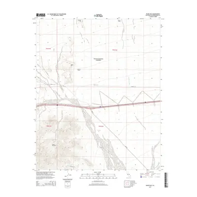
2015 Map of Blind Hills
USGS Topo · Published 2015About this map
The Mojave National Preserve anchors this landscape, illustrating the intersection of modern transit and protected desert wilderness. The southern portion of the map is dominated by the Clipper Mountains, where the Hummingbird Trl leads to the isolated Hummingbird Spring. This water source represents a vital ecological point in an otherwise arid environment, contrasted by the broad alluvial drainage of Black Canyon Wash as it descends through Fenner Valley. To the north, the namesake Blind Hills and Halfway Hill rise from the desert floor, surrounded by a network of utilitarian routes like Essex Rd and Hidden Hill Rd that skirt the foothills. The survey provides a clear view of the topography before the vast expanses of the Mojave Desert, highlighting the corridors used by travelers moving through this corner of San Bernardino County.
Find a feature on this map
15 named features on this map. Tap any name to fly to it.
Don’t see what you’re looking for? This feature index may not catch every label — zoom into the map to look around manually.
Map Details
Editions of this 2015 Blind Hills Map
This is the sole edition of this map. No revisions or reprints were ever made.
Other maps of this area

1942 · Amboy
USGS Topo · 1:250,000

1943 · Amboy
USGS Topo · 1:250,000

1943 · Essex
USGS Topo · 1:62,500

1943 · Danby
USGS Topo · 1:62,500

1943 · Fenner
USGS Topo · 1:62,500

1954 · Needles
USGS Topo · 1:250,000

1956 · Needles
USGS Topo · 1:250,000

1956 · Fenner
USGS Topo · 1:62,500

1956 · Essex
USGS Topo · 1:62,500

1956 · Colton Well
USGS Topo · 1:62,500