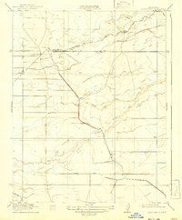
1918 Map of Bliss Ranch
USGS Topo · Published 1942About this map
The Chowchilla River and its seasonal drainages define the landscape along the Merced Co Madera Co boundary line during the early twentieth century. This was a period of extensive ranching and nascent water management in the Central Valley, evidenced by the large tracts belonging to the Bliss Ranch and Chowchilla Ranch. The presence of the Baxter Feeding Canal and numerous scattered wells suggests the transition toward more intensive irrigation for agriculture. Long-distance transit is represented by the Merced and Los Banos Road and Lincoln Road, which intersect this open terrain. The topography, surveyed by J.H. LeFeaver and R.M. Wilson, highlights the importance of seasonal watercourses like Ash Creek and Little Ash Creek in an otherwise arid ranching environment.
Find a feature on this map
11 named features on this map. Tap any name to fly to it.
Don’t see what you’re looking for? This feature index may not catch every label — zoom into the map to look around manually.
Map Details
Editions of this 1918 Bliss Ranch Map
2 editions found
Other maps of this area

1913 · Panoche
USGS Topo · 1:125,000

1916 · Santa Rita Bridge
USGS Topo · 1:24,000

1918 · Bliss Ranch
USGS Topo · 1:31,680

1918 · Lingard
USGS Topo · 1:31,680

1918 · Chowchilla
USGS Topo · 1:31,680

1918 · Sandy Mush
USGS Topo · 1:31,680

1919 · Plainsberg
USGS Topo · 1:31,680

1920 · Santa Rita Bridge
USGS Topo · 1:31,680

1922 · Oxalis
USGS Topo · 1:31,680

1922 · Santa Rita Bridge
USGS Topo · 1:31,680