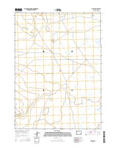
2014 Map of Blitzen
USGS Topo · Published 2014About this map
Blitzen sits as a quiet focal point in the expansive basin of the Catlow Valley in southeastern Oregon. This 2014 survey documents the sparse settlement patterns and vast land divisions of Harney County, illustrating the transition of high-desert ranching country into the 21st century. The landscape is defined by its massive scale and open reaches, where travel is dictated by long-distance routes like Catlow Valley Rd and Valley Rd.
Find a feature on this map
8 named features on this map. Tap any name to fly to it.
Don’t see what you’re looking for? This feature index may not catch every label — zoom into the map to look around manually.
Map Details
Editions of this 2014 Blitzen Map
This is the sole edition of this map. No revisions or reprints were ever made.
Other maps of this area

1955 · Adel
USGS Topo · 1:250,000

1957 · Adel
USGS Topo · 1:250,000

1958 · Adel
USGS Topo · 1:250,000

1962 · Adel
USGS Topo · 1:250,000

1967 · Roaring Springs
USGS Topo · 1:24,000

1971 · Fish Fin Rim
USGS Topo · 1:24,000

1971 · Blitzen
USGS Topo · 1:24,000

1971 · Garrison Lake
USGS Topo · 1:24,000

1971 · Butler Hill
USGS Topo · 1:24,000
1971 · Coyote Gap
USGS Topo · 1:24,000