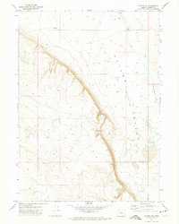
1971 Map of Coyote Gap
USGS Topo · Published 1974About this map
Catlow Valley dominates this high-desert landscape in southeastern Oregon, where a sharp rimrock escarpment drops nearly one thousand feet into the arid basin. Water management is the primary narrative of this cattle country, evidenced by a scattered network of improvements like Well No 2, Well No 7, and the AP Well. This 1971 field-checked survey reveals the logistical footprint of ranching operations centered around Coyote Gap Corral, which sits at the base of the Coyote Gap passage through the rim. The inclusion of ephemeral features like Garrison Lake and various dry holes like the Dry Well northwest of the escarpment illustrates the challenges of maintaining livestock in this isolated corner of Harney County. The topography highlights a stark contrast between the elevated plateau and the lower-lying depression, a transition zone critical for local rangeland navigation.
Find a feature on this map
10 named features on this map. Tap any name to fly to it.
Don’t see what you’re looking for? This feature index may not catch every label — zoom into the map to look around manually.
Map Details
Editions of this 1971 Coyote Gap Map
This is the sole edition of this map. No revisions or reprints were ever made.
Other maps of this area

1955 · Adel
USGS Topo · 1:250,000

1957 · Adel
USGS Topo · 1:250,000

1958 · Adel
USGS Topo · 1:250,000

1962 · Adel
USGS Topo · 1:250,000

1971 · Fish Fin Rim
USGS Topo · 1:24,000

1971 · Square Mountain
USGS Topo · 1:24,000

1971 · Surveyors Lake
USGS Topo · 1:24,000

1971 · Blitzen
USGS Topo · 1:24,000

1971 · Coyote Gap SE
USGS Topo · 1:24,000

1971 · Garrison Lake
USGS Topo · 1:24,000