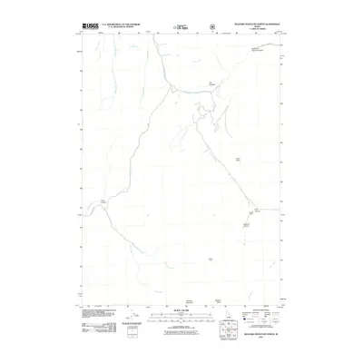
2011 Map of Blizzard Mountain North
USGS Topo · Published 2011About this map
Blizzard Mountain and the surrounding high-elevation terrain of Blaine County define this section of the Idaho landscape. The map reveals a network of drainages and canyons that have long shaped local land use, from the Iron Mine Creek drainage in the south to the sharp formations of The Needles in the north. Settlement is sparse, represented by isolated landmarks like the Brockie Ranch near Price Canyon and the Tunnel Cabin, suggesting a history of seasonal ranching or resource extraction rather than dense habitation.
Find a feature on this map
24 named features on this map. Tap any name to fly to it.
Don’t see what you’re looking for? This feature index may not catch every label — zoom into the map to look around manually.
Map Details
Editions of this 2011 Blizzard Mountain North Map
This is the sole edition of this map. No revisions or reprints were ever made.
Other maps of this area

1935 · MacKay
USGS Topo · 1:96,000

1955 · Idaho Falls
USGS Topo · 1:250,000

1958 · Idaho Falls
USGS Topo · 1:250,000

1960 · Muldoon Canyon
USGS Topo · 1:62,500

1960 · Grouse
USGS Topo · 1:62,500

1972 · Inferno Cone
USGS Topo · 1:24,000

1972 · Blizzard Mtn South
USGS Topo · 1:24,000

1978 · Craters Of The Moon
USGS Topo · 1:100,000
1979 · Fish Creek Reservoir
USGS Topo · 1:24,000
1988 · Arco
USGS Topo · 1:100,000