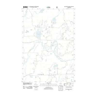
2011 Map of Blockhouse Lake
USGS Topo · Published 2011About this map
The South Fork Flambeau River carves through this northern Wisconsin landscape, regulated by the Sugarbush Dam in a region defined by its dense network of waterways and glacial lakes. This 2011 survey illustrates the land's transition into a recreational and managed forest area, anchored by the Flambeau Trails Parking Area and the Fifield Lookout Tower. The terrain is marked by uniquely named water bodies like Iodine Lake, Planet Lake, and the central Blockhouse Lake. While many areas are accessed via forest routes like Singer Rd and Lueder Rd, the map reveals the complex drainage systems of Hay Creek and Threemile Creek. These features underscore the importance of water management and forest conservation in Price County, providing a clear record of the area's modern infrastructure and natural resources.
Find a feature on this map
38 named features on this map. Tap any name to fly to it.
Don’t see what you’re looking for? This feature index may not catch every label — zoom into the map to look around manually.
Map Details
Editions of this 2011 Blockhouse Lake Map
This is the sole edition of this map. No revisions or reprints were ever made.
Other maps of this area

1940 · Mercer
USGS Topo · 1:48,000

1940 · Butternut
USGS Topo · 1:48,000

1941 · Park Falls
USGS Topo · 1:48,000

1941 · Pike Lake
USGS Topo · 1:48,000

1942 · Pike Lake
USGS Topo · 1:48,000

1943 · Park Falls
USGS Topo · 1:48,000

1945 · Mercer
USGS Topo · 1:48,000

1947 · Park Falls
USGS Topo · 1:48,000

1947 · Butternut
USGS Topo · 1:48,000

1947 · Mercer
USGS Topo · 1:48,000