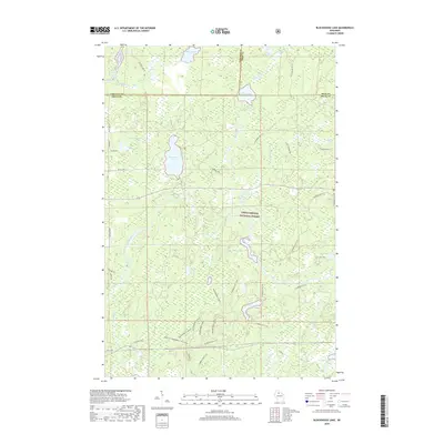
2018 Map of Blockhouse Lake
USGS Topo · Published 2018About this map
Chequamegon National Forest defines this northern Wisconsin landscape where the borders of Price, Ashland, and Iron counties converge. The area is characterized by an intricate network of waterways and glacial lakes, most notably Blockhouse Lake and Hoffman Lake. The South Fork Flambeau River winds through the southwestern section, marked by a series of river features including The Ledge Rapids and Forest Rapids. A complex system of recreational paths, including the Flambeau ATV 111 and the Price Co Snowmobile 101A, overlays the older logging and service roads like Old 182 Rd and Hoffman Lake Rd. The map illustrates a modern era of forest management and public recreation, where industrial timber history has evolved into a landscape of seasonal trails and protected wetlands near Beaverdam Lake and Iodine Lake.
Find a feature on this map
56 named features on this map. Tap any name to fly to it.
Don’t see what you’re looking for? This feature index may not catch every label — zoom into the map to look around manually.
Map Details
Editions of this 2018 Blockhouse Lake Map
This is the sole edition of this map. No revisions or reprints were ever made.
Other maps of this area

1940 · Mercer
USGS Topo · 1:48,000

1940 · Butternut
USGS Topo · 1:48,000

1941 · Park Falls
USGS Topo · 1:48,000

1941 · Pike Lake
USGS Topo · 1:48,000

1942 · Pike Lake
USGS Topo · 1:48,000

1943 · Park Falls
USGS Topo · 1:48,000

1945 · Mercer
USGS Topo · 1:48,000

1947 · Park Falls
USGS Topo · 1:48,000

1947 · Butternut
USGS Topo · 1:48,000

1947 · Mercer
USGS Topo · 1:48,000