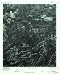
1975 Map of Blocton NE
USGS Topo · Published 1977About this map
Green Pond serves as the primary landmark on this mid-1970s orthophotoquad, which uses aerial photography to capture the intricate texture of the Alabama landscape. Produced by the Geological Survey in cooperation with the Soil Conservation Service, this imagery emphasizes the region's topography through sharp tonal shifts. The surface is defined by a dense network of ridges and drainage patterns, illustrating how timber management and land use shaped the terrain in the years following World War II. Unlike a traditional line-drawn map, this aerial perspective provides a literal view of the clearings and forest cover surrounding the settlement, offering a unique resource for those studying the physical history of this part of Bibb County.
Find a feature on this map
1 named feature on this map. Tap any name to fly to it.
Don’t see what you’re looking for? This feature index may not catch every label — zoom into the map to look around manually.
Map Details
Editions of this 1975 Blocton NE Map
This is the sole edition of this map. No revisions or reprints were ever made.
Other maps of this area

1890 · Bessemer
USGS Topo · 1:125,000

1892 · Bessemer
USGS Topo · 1:125,000

1899 · Brookwood
USGS Topo · 1:125,000

1905 · Bessemer Iron District
USGS Topo · 1:62,500

1907 · Bessemer Special
USGS Topo · 1:62,500

1910 · Montevallo
USGS Topo · 1:62,500

1927 · Adger
USGS Topo · 1:48,000

1932 · Yolande
USGS Topo · 1:62,500

1934 · Blocton
USGS Topo · 1:48,000

1935 · Yolande
USGS Topo · 1:62,500