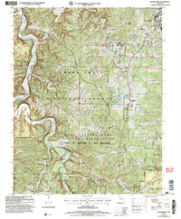
2004 Map of Bloodland
USGS Topo · Published 2006About this map
Fort Leonard Wood dominates the eastern and southern portions of this landscape, where military infrastructure meets the dense woodlands of the Mark Twain National Forest. The map documents a significant transformation of land use, identifying the locations of Bloodland (Site) and Cookville (Site), indicating where former civilian communities were absorbed into the Fort Leonard Wood Military Reservation. This transition from rural settlement to military training ground is further evidenced by several isolated burial grounds, such as McCann Cem and Friendship Cem, which remain as markers of the area's earlier pioneer history.
Find a feature on this map
28 named features on this map. Tap any name to fly to it.
Don’t see what you’re looking for? This feature index may not catch every label — zoom into the map to look around manually.
Map Details
Editions of this 2004 Bloodland Map
This is the sole edition of this map. No revisions or reprints were ever made.
Other maps of this area

1936 · Waynesville
USGS Topo · 1:48,000

1941 · Big Piney
USGS Topo · 1:62,500

1942 · Waynesville
USGS Topo · 1:62,500

1943 · Richland
USGS Topo · 1:62,500

1943 · Big Piney
USGS Topo · 1:62,500

1943 · Drynob
USGS Topo · 1:62,500

1944 · Waynesville
USGS Topo · 1:62,500

1954 · Springfield
USGS Topo · 1:250,000

1954 · Drynob
USGS Topo · 1:62,500
1954 · Big Piney
USGS Topo · 1:62,500