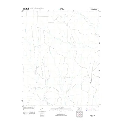
2012 Map of Bloom SE
USGS Topo · Published 2012About this map
Letitia and the surrounding plains of Clark County characterize this part of the Kansas landscape as it appeared in the early 21st century. The terrain is defined by a dense network of watercourses, where the Bluff Cr and Hackberry Cr systems drain the northern reaches, while the south is marked by the split branches of W Br Bear Cr and E Br Bear Cr. A notable elevation point, Mount Nebo, stands in the southeast, providing a rare topographical landmark in a region otherwise dominated by subtle stream valleys like Casino Cr. This 2012 survey captures the area's rural character, showing the sparse infrastructure of the time, such as Clark Co Lake Rd, which provides access to the local interior. The arrangement of these creeks illustrates the natural drainage patterns that have dictated local land use and property boundaries for generations.
Find a feature on this map
8 named features on this map. Tap any name to fly to it.
Don’t see what you’re looking for? This feature index may not catch every label — zoom into the map to look around manually.
Map Details
Editions of this 2012 Bloom SE Map
This is the sole edition of this map. No revisions or reprints were ever made.
Other maps of this area

1894 · Sitka
USGS Topo · 1:62,500

1896 · Ashland
USGS Topo · 1:125,000

1955 · Pratt
USGS Topo · 1:250,000

1959 · Pratt
USGS Topo · 1:250,000

1967 · Bloom
USGS Topo · 1:24,000

1972 · Ashland NW
USGS Topo · 1:24,000
1972 · Ashland
USGS Topo · 1:24,000

1979 · Sitka
USGS Topo · 1:24,000

1979 · Bloom SE
USGS Topo · 1:24,000
1979 · Simmons Creek
USGS Topo · 1:24,000