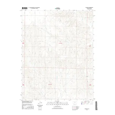
2015 Map of Bloom SE
USGS Topo · Published 2015About this map
Mt Nebo rises as a prominent landmark in this segment of Clark County, overlooking a landscape defined by an intricate network of drainage systems. This 2015 survey illustrates the dissected plains of southwest Kansas, where the headwaters and branches of several significant creeks converge. The map documents the courses of Bluff Cr and Hackberry Cr, alongside the branching paths of W Br Bear Cr and E Br Bear Cr. A sparse grid of county roads, including CR 14 and CR 15, provides the primary access through these townships, following section lines across the high ground between the seasonal watercourses. The inclusion of Casino Cr further details the localized hydrology, while the township and range boundaries of t31s r23w and surrounding sections provide the essential cadastral framework used by landholders and researchers to pin down specific rural tracts.
Find a feature on this map
17 named features on this map. Tap any name to fly to it.
Don’t see what you’re looking for? This feature index may not catch every label — zoom into the map to look around manually.
Map Details
Editions of this 2015 Bloom SE Map
This is the sole edition of this map. No revisions or reprints were ever made.
Other maps of this area

1894 · Sitka
USGS Topo · 1:62,500

1896 · Ashland
USGS Topo · 1:125,000

1955 · Pratt
USGS Topo · 1:250,000

1959 · Pratt
USGS Topo · 1:250,000

1967 · Bloom
USGS Topo · 1:24,000

1972 · Ashland NW
USGS Topo · 1:24,000
1972 · Ashland
USGS Topo · 1:24,000

1979 · Sitka
USGS Topo · 1:24,000

1979 · Bloom SE
USGS Topo · 1:24,000
1979 · Simmons Creek
USGS Topo · 1:24,000