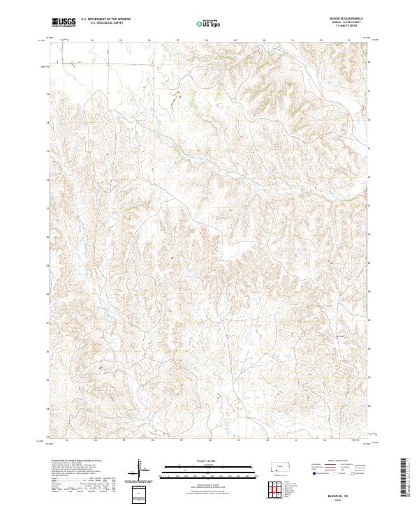
2022 Map of Bloom SE
USGS Topo · Published 2022About this map
Hackberry Creek and its various tributaries carve a complex drainage pattern across this section of Clark County, Kansas. The terrain is defined by the significant prominence of Mt Nebo in the southeast, rising above the surrounding draws and breaks. Water management and local transit are dictated by the paths of Bluff Cr and the branching reaches of W Br Bear Cr and E Br Bear Cr, which create a landscape of intermittent stream beds and varying elevations. This modern topographic study, based on data from the U.S. Geological Survey and Census Bureau, shows a sparse network of section-line roads like CR 14 and CR 20, reflecting the vast agricultural and ranching parcels that characterize this part of the High Plains.
Find a feature on this map
17 named features on this map. Tap any name to fly to it.
Don’t see what you’re looking for? This feature index may not catch every label — zoom into the map to look around manually.
Map Details
Editions of this 2022 Bloom SE Map
This is the sole edition of this map. No revisions or reprints were ever made.
Other maps of this area

1894 · Sitka
USGS Topo · 1:62,500

1896 · Ashland
USGS Topo · 1:125,000

1955 · Pratt
USGS Topo · 1:250,000

1959 · Pratt
USGS Topo · 1:250,000

1967 · Bloom
USGS Topo · 1:24,000

1972 · Ashland NW
USGS Topo · 1:24,000
1972 · Ashland
USGS Topo · 1:24,000

1979 · Sitka
USGS Topo · 1:24,000

1979 · Bloom SE
USGS Topo · 1:24,000
1979 · Simmons Creek
USGS Topo · 1:24,000