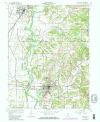
1966 Map of Bloomfield
USGS Topo · Published 1981About this map
The White River and its expansive floodplain dominate this mid-century look at central Greene County, where the meandering water creates distinct landmarks like Rock Riffle and flows past the riverfront settlement of Elliston. To the north, the confluence of the Eel River and the White River sits near Worthington and the old community of Point Commerce. This landscape is marked by numerous family and community burial grounds, including Stalcup Cem and Goodwin Cem, reflecting generations of local settlement. The eastern hills rise toward Persimmon Ridge, dissected by creek branches such as Richland Creek and Plummer Creek. Transport networks are well-defined, showing the paths of the Illinois Central Gulf and Conrail railroads as they navigate the river valley and connect the smaller hubs of Tulip and Beechwood Lake.
Find a feature on this map
56 named features on this map. Tap any name to fly to it.
Don’t see what you’re looking for? This feature index may not catch every label — zoom into the map to look around manually.
Map Details
Editions of this 1966 Bloomfield Map
2 editions found
Other maps of this area

1908 · Bloomfield
USGS Topo · 1:62,500

1938 · Coal City
USGS Topo · 1:24,000

1938 · Switz City
USGS Topo · 1:24,000

1943 · Lyons
USGS Topo · 1:24,000

1947 · Switz City
USGS Topo · 1:24,000

1948 · Coal City
USGS Topo · 1:24,000

1950 · Arney
USGS Topo · 1:24,000

1950 · Switz City
USGS Topo · 1:24,000

1951 · Bloomfield
USGS Topo · 1:24,000
1953 · Coal City
USGS Topo · 1:24,000