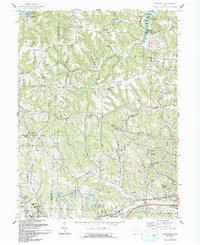
1993 Map of Bloomfield
USGS Topo · Published 1993About this map
Wills Creek Lake dominates the northern landscape of this Guernsey County survey, where the rolling hills are marked by a dense network of country roads and small rural settlements. The area shows a transition from traditional agricultural patterns to modern infrastructure, evidenced by the presence of numerous gas wells and a Strip Mine near Bloomfield. The map provides a detailed view of local genealogy, documenting small burial grounds like Northfield Cem and Sarchet Run Cem, alongside community landmarks such as the Pike Sch and Lebanon Ch. Near the southern boundary, the terrain levels out along Crooked Creek as it nears the settlement of Cassell, while the hilltop community of College Hill overlooks the surrounding valleys from its position near the radio towers.
Find a feature on this map
70 named features on this map. Tap any name to fly to it.
Don’t see what you’re looking for? This feature index may not catch every label — zoom into the map to look around manually.
Map Details
Editions of this 1993 Bloomfield Map
This is the sole edition of this map. No revisions or reprints were ever made.
Other maps of this area

1908 · Conesville
USGS Topo · 1:62,500

1909 · Cambridge
USGS Topo · 1:62,500

1910 · Philo
USGS Topo · 1:62,500

1910 · Conesville
USGS Topo · 1:62,500

1911 · Cumberland
USGS Topo · 1:62,500

1912 · Cambridge
USGS Topo · 1:62,500

1949 · Clarksburg
USGS Topo · 1:250,000

1951 · Canton
USGS Topo · 1:250,000

1953 · Canton
USGS Topo · 1:250,000

1956 · Clarksburg
USGS Topo · 1:250,000