
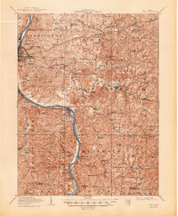
1910 Map of Philo
USGS Topo · Published 1938About this map
The Muskingum River carves a deep valley through this southeastern Ohio landscape, serving as a primary corridor for both the Baltimore and Ohio System and the Zanesville and Western RR. Surveyed in the first decade of the twentieth century, the map reveals a region defined by its ridge-and-hollow topography, where family-named landmarks like Smith Mill and Le Fevers Ford indicate a local economy still tied to the river's flow.
Find a feature on this map
101 named features on this map. Tap any name to fly to it.
Don’t see what you’re looking for? This feature index may not catch every label — zoom into the map to look around manually.
Map Details
Editions of this 1910 Philo Map
2 editions found
Other maps of this area

1908 · Conesville
USGS Topo · 1:62,500

1909 · Caldwell
USGS Topo · 1:62,500

1909 · Cambridge
USGS Topo · 1:62,500

1910 · Frazeysburg
USGS Topo · 1:62,500

1910 · Zanesville
USGS Topo · 1:62,500

1910 · Conesville
USGS Topo · 1:62,500

1910 · Mc Connelsville
USGS Topo · 1:62,500

1911 · New Lexington
USGS Topo · 1:62,500

1911 · Cumberland
USGS Topo · 1:62,500

1912 · Caldwell
USGS Topo · 1:62,500