1912 Map of Caldwell
USGS Topo · Published 1943About this map
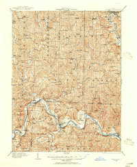
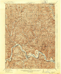
The Muskingum River winds through the southern reaches of this landscape, anchoring a series of small riverside communities including Waterford, Beverly, and Lowell. This 1908–1909 survey records the region's complex topography and agrarian settlement pattern, where narrow ridges like Old Tom Ridge and Tick Ridge separate deeply incised creek valleys. The drainage system is particularly well-defined, with the Dye Fork and Meigs Creek feeding into larger systems that sustained early local industry.
Find a feature on this map
130 named features on this map. Tap any name to fly to it.
Don’t see what you’re looking for? This feature index may not catch every label — zoom into the map to look around manually.
Map Details
Editions of this 1912 Caldwell Map
This is the sole edition of this map. No revisions or reprints were ever made.