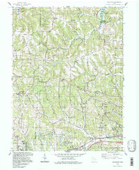
1994 Map of Bloomfield
USGS Topo · Published 1998About this map
Wills Creek Lake dominates the northern reaches of this landscape, where the Indian Camp Covered Bridge spans the water near the Indian Camp settlement. The terrain is marked by family-named landmarks and high points like Twin Sister Knobs and Stoney Point, reflecting a rural Ohio character where small crossroads and cemeteries define the community layout. Significant educational institutions such as John Glenn High Sch and East Muskingum Middle Sch are established in the southern portion of the quadrangle near New Concord.
Find a feature on this map
71 named features on this map. Tap any name to fly to it.
Don’t see what you’re looking for? This feature index may not catch every label — zoom into the map to look around manually.
Map Details
Editions of this 1994 Bloomfield Map
This is the sole edition of this map. No revisions or reprints were ever made.
Other maps of this area

1908 · Conesville
USGS Topo · 1:62,500

1909 · Cambridge
USGS Topo · 1:62,500

1910 · Philo
USGS Topo · 1:62,500

1910 · Conesville
USGS Topo · 1:62,500

1911 · Cumberland
USGS Topo · 1:62,500

1912 · Cambridge
USGS Topo · 1:62,500

1949 · Clarksburg
USGS Topo · 1:250,000

1951 · Canton
USGS Topo · 1:250,000

1953 · Canton
USGS Topo · 1:250,000

1956 · Clarksburg
USGS Topo · 1:250,000