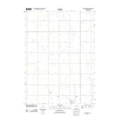
2011 Map of Bloomfield SE
USGS Topo · Published 2011About this map
Wausa occupies the southern edge of this Knox County landscape, serving as a focal point for the surrounding agricultural region. The town is flanked by historic burial grounds, including Thabor Cemetery to the west and Woodlawn Cemetery to the north, which provide valuable reference points for local genealogical research. North of the community, Gladstone Park Campground offers a recreational space near the residential streets. The terrain is defined by several converging drainage systems, notably the North Fork Elkhorn River and Little Bazile Creek, which create a complex network of seasonal waterways through the sectional grid. Aviation history in the area is represented by the privately situated Frevert Airstrip, while a rigid network of rural roads, such as 880 RD and 548 Ave, maintains the connectivity of this Nebraska prairie landscape in the early twenty-first century.
Find a feature on this map
23 named features on this map. Tap any name to fly to it.
Don’t see what you’re looking for? This feature index may not catch every label — zoom into the map to look around manually.
Map Details
Editions of this 2011 Bloomfield SE Map
This is the sole edition of this map. No revisions or reprints were ever made.
Other maps of this area

1955 · Sioux City
USGS Topo · 1:250,000

1958 · Sioux City
USGS Topo · 1:250,000

1959 · Sioux City
USGS Topo · 1:250,000

1968 · Bloomfield NE
USGS Topo · 1:24,000

1968 · Hartington SW
USGS Topo · 1:24,000

1968 · Bloomfield SE
USGS Topo · 1:24,000

1968 · Crofton
USGS Topo · 1:24,000

1971 · Wausa
USGS Topo · 1:24,000
1971 · Magnet
USGS Topo · 1:24,000

1974 · Lindy
USGS Topo · 1:24,000