
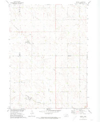
1968 Map of Bloomfield SE
USGS Topo · Published 1971About this map
Wausa anchors the southern portion of this Knox County survey, situated just north of the North Fork Elkhorn River. The landscape is organized into distinct townships including Columbia, Lincoln, and Morton, reflecting the systematic agricultural partitioning of the region. A notable transportation feature is the Old Railroad Grade that winds through the northern sections, signaling changes in the rural infrastructure as rail lines were decommissioned. Local history is preserved at sites like Thabor Cem and Woodlawn Cem, which provide specific points of interest for genealogical research. Waterways such as Bow Creek drain the northern terrain, which transitions from these creek valleys down toward the Elkhorn River basin. This 1968 field-checked map captures the area as part of the Missouri River Basin development program, documenting a period of established farming communities and evolving transit routes.
Find a feature on this map
14 named features on this map. Tap any name to fly to it.
Don’t see what you’re looking for? This feature index may not catch every label — zoom into the map to look around manually.
Map Details
Editions of this 1968 Bloomfield SE Map
This is the sole edition of this map. No revisions or reprints were ever made.
Other maps of this area

1955 · Sioux City
USGS Topo · 1:250,000

1958 · Sioux City
USGS Topo · 1:250,000

1959 · Sioux City
USGS Topo · 1:250,000

1968 · Bloomfield NE
USGS Topo · 1:24,000

1968 · Hartington SW
USGS Topo · 1:24,000

1968 · Crofton
USGS Topo · 1:24,000

1971 · Wausa
USGS Topo · 1:24,000
1971 · Magnet
USGS Topo · 1:24,000

1974 · Lindy
USGS Topo · 1:24,000

1974 · Midland
USGS Topo · 1:24,000