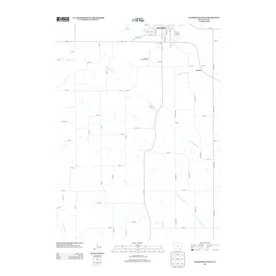
2013 Map of Bloomfield South
USGS Topo · Published 2013About this map
The city of Bloomfield serves as the focal point for this southern Iowa landscape, where the urban grid meets the agricultural reaches of Davis County. The town's layout is defined by historical corridors like Old Hwy Rd, Karr Ave, and S Railroad St, reflecting a community built around transportation and commerce. Just northwest of the city center, Lake Fisher provides a significant water feature amidst the rolling topography, while the Bloomfield Municipal Airport marks the transition from town to countryside.
Find a feature on this map
58 named features on this map. Tap any name to fly to it.
Don’t see what you’re looking for? This feature index may not catch every label — zoom into the map to look around manually.
Map Details
Editions of this 2013 Bloomfield South Map
This is the sole edition of this map. No revisions or reprints were ever made.
Other maps of this area

1954 · Centerville
USGS Topo · 1:250,000

1956 · Ottumwa South
USGS Topo · 1:62,500

1957 · Centerville
USGS Topo · 1:250,000

1958 · Centerville
USGS Topo · 1:250,000
1968 · Paris
USGS Topo · 1:24,000
1979 · West Grove
USGS Topo · 1:24,000
1979 · Floris
USGS Topo · 1:24,000
1979 · Pulaski
USGS Topo · 1:24,000
1979 · Lancaster
USGS Topo · 1:24,000
1979 · Bloomfield South
USGS Topo · 1:24,000