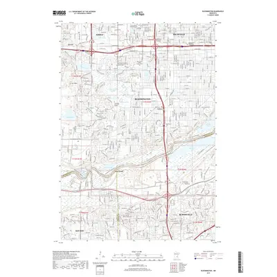
2019 Map of Bloomington
USGS Topo · Published 2019About this map
Bloomington and its neighboring suburbs of Edina and Richfield form a dense landscape of mid-century growth and complex riparian geography along the Minnesota River. The map captures the significant industrial and maritime presence at Port Cargill, situated on the northern bank of the river just above the Minnesota River Bottoms. This area is characterized by a high density of institutional sites, including Normandale Community College and several specialized medical and business universities. A notable cluster of faith-based landmarks and cemeteries, such as the Minneapolis Jewish Cem, B'Nai Emet Cem, and the Church of the Assumption Catholic Cem, reflects the diverse social history and community development south of the Twin Cities. Transportation remains a central theme, with the Soo Line railroad and a grid of residential streets interwoven with water bodies like Penn Lake and Hyland Lake.
Find a feature on this map
177 named features on this map. Tap any name to fly to it.
Don’t see what you’re looking for? This feature index may not catch every label — zoom into the map to look around manually.
Map Details
Editions of this 2019 Bloomington Map
This is the sole edition of this map. No revisions or reprints were ever made.
Other maps of this area

1896 · Minneapolis
USGS Topo · 1:62,500

1896 · St. Paul
USGS Topo · 1:62,500

1901 · Minneapolis
USGS Topo · 1:62,500

1951 · St. Paul West
USGS Topo · 1:24,000

1951 · St. Paul SW
USGS Topo · 1:24,000

1951 · St. Paul
USGS Topo · 1:62,500

1952 · Minneapolis South
USGS Topo · 1:24,000

1953 · Saint Paul
USGS Topo · 1:250,000

1954 · Hopkins
USGS Topo · 1:24,000

1954 · Bloomington
USGS Topo · 1:24,000