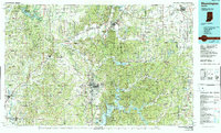
1986 Map of Bloomington
USGS Topo · Published 1990About this map
The White River and its various forks anchor this mid-1980s landscape, winding through a region defined by extensive public lands and growing university and county seats. The city of Bloomington serves as a central hub, surrounded by a complex network of recreational and protected areas including the Hoosier National Forest, Morgan-Monroe State Forest, and the Charles C. Deam Wilderness. To the east, the Camp Atterbury Military Reservation occupies a significant portion of the terrain near Franklin, while the sprawling waters of Monroe Lake and Cagles Mill Lake illustrate the 20th-century water management and recreation infrastructure of Southern Indiana.
Find a feature on this map
204 named features on this map. Tap any name to fly to it.
Don’t see what you’re looking for? This feature index may not catch every label — zoom into the map to look around manually.
Map Details
Editions of this 1986 Bloomington Map
3 editions found
Other maps of this area

1908 · Clay City
USGS Topo · 1:48,000

1908 · Bloomington
USGS Topo · 1:48,000

1908 · Bloomfield
USGS Topo · 1:62,500

1910 · Clay City
USGS Topo · 1:62,500

1910 · Bloomington
USGS Topo · 1:62,500

1934 · Bedford
USGS Topo · 1:48,000

1935 · Oolitic
USGS Topo · 1:48,000

1937 · Bedford
USGS Topo · 1:62,500

1938 · Coal City
USGS Topo · 1:24,000

1938 · Switz City
USGS Topo · 1:24,000