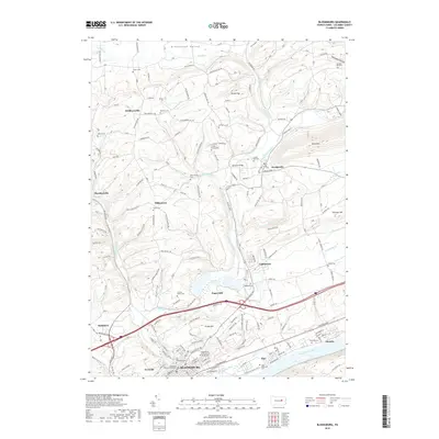
2019 Map of Bloomsburg
USGS Topo · Published 2019About this map
The Susquehanna River and the winding Fishing Creek define the geography of this central Pennsylvania corridor, where the town of Bloomsburg serves as a significant regional anchor. This survey details the institutional footprint of the Bloomsburg University of Pennsylvania and the Columbia County Courthouse, alongside smaller outlying settlements like Orangeville, Lightstreet, and Almedia. The landscape is a mix of agricultural valley land and prominent ridges such as Knob Mtn, with numerous small family burial grounds and historical landmarks like Bowman Bridge scattered across the township. Local history is deeply etched into the terrain through features such as the County Home Cem and Crouse Family Cem, while the northern reaches transition into the quieter topography of Green Creek and Greenwood Valley.
Find a feature on this map
156 named features on this map. Tap any name to fly to it.
Don’t see what you’re looking for? This feature index may not catch every label — zoom into the map to look around manually.
Map Details
Editions of this 2019 Bloomsburg Map
This is the sole edition of this map. No revisions or reprints were ever made.
Other maps of this area

1889 · Catawissa
USGS Topo · 1:62,500

1892 · Catawissa
USGS Topo · 1:62,500

1892 · Shamokin
USGS Topo · 1:62,500

1893 · Shamokin
USGS Topo · 1:62,500

1894 · Catawissa
USGS Topo · 1:62,500

1894 · Bloomsburg
USGS Topo · 1:62,500

1935 · Hughesville
USGS Topo · 1:62,500

1943 · Shamokin
USGS Topo · 1:62,500

1947 · Bloomsburg
USGS Topo · 1:24,000

1947 · Stillwater
USGS Topo · 1:24,000