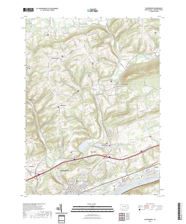
2023 Map of Bloomsburg
USGS Topo · Published 2023About this map
Bloomsburg anchors this Columbia County landscape, situated along the northern bank of the Susquehanna River and dominated by the expansive campus of Bloomsburg University of Pennsylvania. The town's civic heart is marked by the Columbia County Courthouse, while its periphery transitions into a mix of suburban growth and steep ridge terrain. North of the city, the landscape rises toward Knob Mountain and Turkey Hill, with Fishing Creek cutting a significant valley through the hills.
Find a feature on this map
95 named features on this map. Tap any name to fly to it.
Don’t see what you’re looking for? This feature index may not catch every label — zoom into the map to look around manually.
Map Details
Editions of this 2023 Bloomsburg Map
This is the sole edition of this map. No revisions or reprints were ever made.
Other maps of this area

1889 · Catawissa
USGS Topo · 1:62,500

1892 · Catawissa
USGS Topo · 1:62,500

1892 · Shamokin
USGS Topo · 1:62,500

1893 · Shamokin
USGS Topo · 1:62,500

1894 · Catawissa
USGS Topo · 1:62,500

1894 · Bloomsburg
USGS Topo · 1:62,500

1935 · Hughesville
USGS Topo · 1:62,500

1943 · Shamokin
USGS Topo · 1:62,500

1947 · Bloomsburg
USGS Topo · 1:24,000

1947 · Stillwater
USGS Topo · 1:24,000
Featured Places
- Bloomsburg, PA
- Greenwood Township, PA
- North Centre Township, PA
- Scott Township, PA
- Mount Pleasant Township, PA