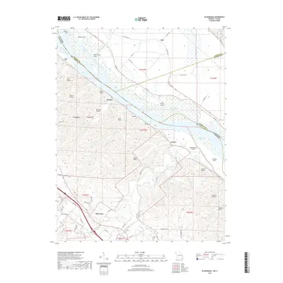
2017 Map of Bloomsdale
USGS Topo · Published 2017About this map
Mississippi River bottomlands and the rising bluffs of Ste. Genevieve County define this landscape, where the state boundary between Missouri and Illinois meanders through a network of chutes and islands. The settlement of Bloomsdale occupies the southwestern corner, while smaller localities like Brickeys and Needmore sit near the river's edge. This 2017 survey reveals a complex hydrological system where Establishment Creek and Fourche a Du Clos drain the interior hills into the river. Notable terrain features such as Fort Chartres Island and Penitentiary Point indicate the historical shifts of the river channel over time. The transition from the flat agricultural plains of Beagles Island to the deeply incised ravines of Wolf Hollow and Magnolia Hollow illustrates the diverse topography of the mid-Mississippi valley, preserved here with contemporary road networks like Levee Rd and Stringtown Rd.
Find a feature on this map
76 named features on this map. Tap any name to fly to it.
Don’t see what you’re looking for? This feature index may not catch every label — zoom into the map to look around manually.
Map Details
Editions of this 2017 Bloomsdale Map
This is the sole edition of this map. No revisions or reprints were ever made.
Other maps of this area

1904 · Farmington
USGS Topo · 1:62,500

1906 · Farmington
USGS Topo · 1:62,500

1907 · Weingarten
USGS Topo · 1:62,500

1909 · Weingarten
USGS Topo · 1:62,500

1915 · Renault
USGS Topo · 1:62,500

1915 · Crystal City
USGS Topo · 1:62,500

1940 · Renault
USGS Topo · 1:62,500

1949 · Saint Louis
USGS Topo · 1:250,000

1949 · Rolla
USGS Topo · 1:250,000

1949 · Crystal City
USGS Topo · 1:62,500