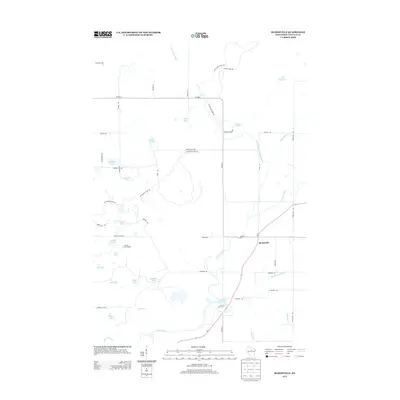
2013 Map of Bloomville
USGS Topo · Published 2013About this map
Bloomville serves as the primary settlement hub in this 2013 survey of northeastern Lincoln County, situated where Wi-17 meets the meandering Prairie River. The landscape is defined by its glacial heritage, featuring a high density of kettle lakes such as Anderson Lake, Lokemoen Lake, and Luecks Lake. A significant section of the Ice Age Natl Scenic Trl winds through the northern half of the map, tracing the terminal moraine and connecting various water bodies like Allen Lake and Wedlers Pond. The drainage network is particularly intricate, with the North Branch Prairie River and Big Hay Meadow Cr feeding into the main river valley. Cultural and industrial markers include the Lincoln County Landfill near Anient Lake and the Prairie Dell Pond further south along the river, illustrating the modern utility of this glaciated terrain.
Find a feature on this map
50 named features on this map. Tap any name to fly to it.
Don’t see what you’re looking for? This feature index may not catch every label — zoom into the map to look around manually.
Map Details
Editions of this 2013 Bloomville Map
This is the sole edition of this map. No revisions or reprints were ever made.
Other maps of this area

1899 · Wausau
USGS Topo · 1:125,000

1902 · Wausau
USGS Topo · 1:125,000

1940 · Parrish
USGS Topo · 1:48,000

1950 · Parrish
USGS Topo · 1:48,000

1950 · Tomahawk
USGS Topo · 1:48,000

1951 · Doering
USGS Topo · 1:48,000

1951 · Merrill
USGS Topo · 1:48,000

1952 · Parrish
USGS Topo · 1:48,000

1952 · Tomahawk
USGS Topo · 1:48,000

1954 · Iron Mountain
USGS Topo · 1:250,000