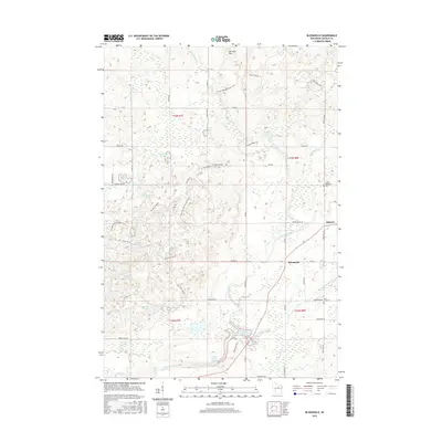
2015 Map of Bloomville
USGS Topo · Published 2015About this map
Bloomville and Gleason sit as the primary hubs of this Lincoln County landscape, where the Prairie River and Big Hay Meadow Creek carve through the glacial terrain of the Harrison Hills. The map details a complex network of recreation and local transit, notably featuring segments of the Ice Age National Scenic Trail as it winds past numerous water bodies like Copper Lake, Allen Lake, and Henson Lake. Genealogical value is found in the location of rural burial sites including Saint Johns Cem near Bloomville and Luther Memorial Cem further north. The southern portion of the sheet is dominated by the Prairie Dells Pond, where the river narrows through a distinct topographical feature. Local roads such as Neider RD and Town Hall RD provide a framework for the scattered homesteads and woodland tracts that characterize this part of northern Wisconsin.
Find a feature on this map
62 named features on this map. Tap any name to fly to it.
Don’t see what you’re looking for? This feature index may not catch every label — zoom into the map to look around manually.
Map Details
Editions of this 2015 Bloomville Map
This is the sole edition of this map. No revisions or reprints were ever made.
Other maps of this area

1899 · Wausau
USGS Topo · 1:125,000

1902 · Wausau
USGS Topo · 1:125,000

1940 · Parrish
USGS Topo · 1:48,000

1950 · Parrish
USGS Topo · 1:48,000

1950 · Tomahawk
USGS Topo · 1:48,000

1951 · Doering
USGS Topo · 1:48,000

1951 · Merrill
USGS Topo · 1:48,000

1952 · Parrish
USGS Topo · 1:48,000

1952 · Tomahawk
USGS Topo · 1:48,000

1954 · Iron Mountain
USGS Topo · 1:250,000