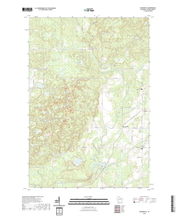
2022 Map of Bloomville
USGS Topo · Published 2022About this map
The Prairie River and its numerous tributaries, including Maniacke Cr and Big Hay Meadow Creek, carve through this central Wisconsin landscape northeast of Merrill. This region is defined by a dense concentration of kettle lakes and wetlands, such as Lokemoen Lake, Swiss Lake, and Copper Lake, which are characteristic of the Harrison Hills glacial topography. Small rural centers like Bloomville and Gleason serve as focal points for the surrounding agricultural and timbered lands. Local history is anchored by the Luther Memorial Cem and Saint John Baptist Catholic Cem, providing specific locations for genealogical research. The mapping of Prairie Dells Pond and various smaller impoundments like 0.9 Reservoir indicates the management of local water resources for recreation or power during the early 21st century.
Find a feature on this map
79 named features on this map. Tap any name to fly to it.
Don’t see what you’re looking for? This feature index may not catch every label — zoom into the map to look around manually.
Map Details
Editions of this 2022 Bloomville Map
This is the sole edition of this map. No revisions or reprints were ever made.
Other maps of this area

1899 · Wausau
USGS Topo · 1:125,000

1902 · Wausau
USGS Topo · 1:125,000

1940 · Parrish
USGS Topo · 1:48,000

1950 · Parrish
USGS Topo · 1:48,000

1950 · Tomahawk
USGS Topo · 1:48,000

1951 · Doering
USGS Topo · 1:48,000

1951 · Merrill
USGS Topo · 1:48,000

1952 · Parrish
USGS Topo · 1:48,000

1952 · Tomahawk
USGS Topo · 1:48,000

1954 · Iron Mountain
USGS Topo · 1:250,000