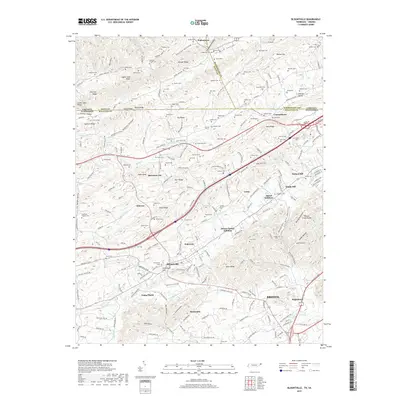
2019 Map of Blountville
USGS Topo · Published 2019About this map
Blountville serves as a central hub in this corner of Northeast Tennessee, where the intersection of major roads and historic valleys defines the landscape. The area is dense with family-named landmarks and ancestral burial grounds, including the Booher's Chapel Cem and Graveyard Hill, reflecting generations of local settlement. To the north, the terrain transitions into the steep ridges of Walker Mtn and Booher Ridge, separated by the long corridor of Rich Valley. Distinct residential pockets like Pullontown, Beechnut City, and the Akard Addition show the outward growth of the region towards the western edges of Bristol. The map reveals a complex hydrography where Reedy Creek and Muddy Creek wind through the limestone ridges, creating the distinctive topography of Upper Cave Ridge and Mid Cave Ridge. This survey provides an essential view of the suburban and rural development patterns as they stood in the late 2010s.
Find a feature on this map
198 named features on this map. Tap any name to fly to it.
Don’t see what you’re looking for? This feature index may not catch every label — zoom into the map to look around manually.
Map Details
Editions of this 2019 Blountville Map
This is the sole edition of this map. No revisions or reprints were ever made.
Other maps of this area

1891 · Roan Mountain
USGS Topo · 1:125,000

1894 · Roan Mountain
USGS Topo · 1:125,000

1897 · Bristol
USGS Topo · 1:125,000

1902 · Bristol
USGS Topo · 1:125,000

1904 · Roan Mountain
USGS Topo · 1:125,000

1934 · Wallace
USGS Topo · 1:24,000

1934 · Bristol
USGS Topo · 1:24,000

1935 · Hilton
USGS Topo · 1:24,000

1935 · Watauga Valley
USGS Topo · 1:48,000

1935 · Mendota
USGS Topo · 1:24,000