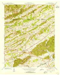
1938 Map of Blountville
USGS Topo · Published 1954About this map
Blountville serves as the focal point of this Tennessee-Virginia borderland survey, with the historic Court House anchoring the settlement just south of the state line. The landscape is defined by the parallel ridges of the Appalachians, including Akard Ridge and Walker Mountain, which channel local life into valleys like Rich Valley. A robust network of rural institutions is evident, from the Fraley Institute and several country schools like Mill Point Sch to local landmarks such as the County Farm and Linville Cave.
Find a feature on this map
48 named features on this map. Tap any name to fly to it.
Don’t see what you’re looking for? This feature index may not catch every label — zoom into the map to look around manually.
Map Details
Editions of this 1938 Blountville Map
This is the sole edition of this map. No revisions or reprints were ever made.
Other maps of this area

1891 · Roan Mountain
USGS Topo · 1:125,000

1894 · Roan Mountain
USGS Topo · 1:125,000

1897 · Bristol
USGS Topo · 1:125,000

1902 · Bristol
USGS Topo · 1:125,000

1904 · Roan Mountain
USGS Topo · 1:125,000

1934 · Wallace
USGS Topo · 1:24,000

1934 · Bristol
USGS Topo · 1:24,000

1935 · Hilton
USGS Topo · 1:24,000

1935 · Watauga Valley
USGS Topo · 1:48,000

1935 · Mendota
USGS Topo · 1:24,000