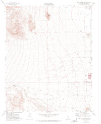
1972 Map of Blue Diamond NE
USGS Topo · Published 1974About this map
Lone Mountain stands as a prominent topographical focal point in this 1972 landscape, marking the western edge of the desert basin before the rise of the Spring Mountains. To the east, the Las Vegas Corp Bdy delineates the early 1970s limits of urban expansion, where the city grid begins to intersect with the arid terrain. The map captures a moment when major thoroughfares like Charleston Blvd, Sahara Ave, and Spring Mtn Road were just beginning to push into the desert from the east.
Find a feature on this map
17 named features on this map. Tap any name to fly to it.
Don’t see what you’re looking for? This feature index may not catch every label — zoom into the map to look around manually.
Map Details
Editions of this 1972 Blue Diamond NE Map
3 editions found
Other maps of this area

1907 · Las Vegas
USGS Topo · 1:250,000

1908 · Las Vegas
USGS Topo · 1:250,000

1952 · Corn Creek Springs
USGS Topo · 1:62,500

1952 · Gass Peak
USGS Topo · 1:62,500

1952 · Blue Diamond
USGS Topo · 1:62,500

1952 · Las Vegas
USGS Topo · 1:62,500

1954 · Las Vegas
USGS Topo · 1:250,000

1957 · Las Vegas
USGS Topo · 1:250,000

1959 · Las Vegas
USGS Topo · 1:250,000

1962 · Las Vegas
USGS Topo · 1:250,000