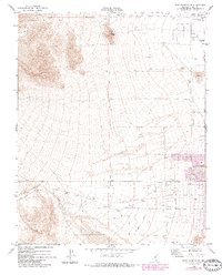
1972 Map of Blue Diamond NE
USGS Topo · Published 1984About this map
Las Vegas expands westward into the desert in this survey reflecting the early 1970s landscape, with later revisions showing the urban footprint pushing toward the base of Lone Mountain. The map captures the transition from open desert terrain, marked by Red Rock Wash and Box Canyon, to a structured grid of developing streets such as Sahara Ave and Charleston Blvd. The Las Vegas Corp Bdy delineates the edge of municipal reach at the time, while land use at the periphery includes industrial activity at various Gravel Pits and the established Memory Gardens (Cem) near Craig Road. This document illustrates the conversion of alluvial fans into residential and commercial corridors, a process further evidenced by the purple-tinted urban extensions along the eastern margin.
Find a feature on this map
16 named features on this map. Tap any name to fly to it.
Don’t see what you’re looking for? This feature index may not catch every label — zoom into the map to look around manually.
Map Details
Editions of this 1972 Blue Diamond NE Map
3 editions found
Other maps of this area

1907 · Las Vegas
USGS Topo · 1:250,000

1908 · Las Vegas
USGS Topo · 1:250,000

1952 · Corn Creek Springs
USGS Topo · 1:62,500

1952 · Gass Peak
USGS Topo · 1:62,500

1952 · Blue Diamond
USGS Topo · 1:62,500

1952 · Las Vegas
USGS Topo · 1:62,500

1954 · Las Vegas
USGS Topo · 1:250,000

1957 · Las Vegas
USGS Topo · 1:250,000

1959 · Las Vegas
USGS Topo · 1:250,000

1962 · Las Vegas
USGS Topo · 1:250,000