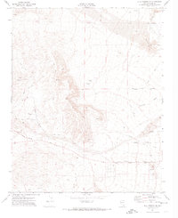
1972 Map of Blue Diamond SE
USGS Topo · Published 1974About this map
The Union Pacific railroad cuts through the arid landscape of Clark County in the early 1970s, serving as a primary corridor near the small siding of Bard. This survey illustrates the early expansion of the Las Vegas Valley's infrastructure, where the desert floor is increasingly marked by a grid of arterial routes including Flamingo Rd, Tropicana Ave, and Sunset Road.
Find a feature on this map
26 named features on this map. Tap any name to fly to it.
Don’t see what you’re looking for? This feature index may not catch every label — zoom into the map to look around manually.
Map Details
Editions of this 1972 Blue Diamond SE Map
2 editions found
Other maps of this area

1907 · Las Vegas
USGS Topo · 1:250,000

1908 · Las Vegas
USGS Topo · 1:250,000

1910 · Ivanpah
USGS Topo · 1:250,000

1912 · Ivanpah
USGS Topo · 1:250,000

1942 · Ivanpah
USGS Topo · 1:250,000

1947 · Kingman
USGS Topo · 1:250,000

1948 · Kingman
USGS Topo · 1:250,000

1952 · Blue Diamond
USGS Topo · 1:62,500

1952 · Las Vegas
USGS Topo · 1:62,500

1954 · Las Vegas
USGS Topo · 1:250,000