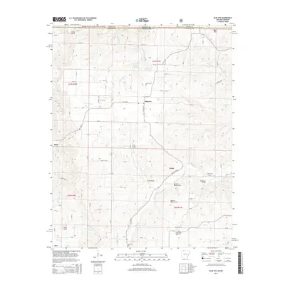
2014 Map of Blue Eye
USGS Topo · Published 2014About this map
Oakgrove and Blue Eye anchor the Missouri-Arkansas border region in this 2014 survey, where the deep drainages of the Ozark Plateau define the local geography. The landscape is characterized by a high concentration of family and community burial grounds, including the Blue Eye Cem, Boyd Cem, and Hale Cem, which provide essential touchpoints for genealogical research in Stone and Carroll counties. The terrain is deeply incised by watercourses like Little Indian Cr and Stillhouse Cr, creating numerous named hollows such as Buzzard Roost Hollow and Stillhouse Hollow. At the southern edge of the map, the small settlement of Cisco sits near Pilot Knob, while the northern border is partially sheltered by the Mark Twain National Forest. The road network, dominated by AR 21 Highway N and Ar-311, traces the ridgelines to connect these dispersed upland communities.
Find a feature on this map
87 named features on this map. Tap any name to fly to it.
Don’t see what you’re looking for? This feature index may not catch every label — zoom into the map to look around manually.
Map Details
Editions of this 2014 Blue Eye Map
This is the sole edition of this map. No revisions or reprints were ever made.
Other maps of this area

1900 · Eureka Springs
USGS Topo · 1:125,000

1901 · Eureka Springs
USGS Topo · 1:125,000

1904 · Harrison
USGS Topo · 1:125,000

1905 · Harrison
USGS Topo · 1:125,000

1907 · Forsyth
USGS Topo · 1:125,000

1927 · Shell Knob
USGS Topo · 1:62,500

1945 · Harrison
USGS Topo · 1:250,000

1949 · Harrison
USGS Topo · 1:250,000

1950 · Shell Knob
USGS Topo · 1:62,500

1954 · Harrison
USGS Topo · 1:250,000