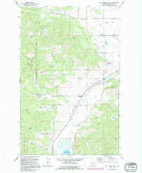
1991 Map of Blue Grass Ridge
USGS Topo · Published 1995About this map
The agricultural and timber landscape of Smith Valley and the surrounding highlands is documented in this 1991 survey, reflecting a region defined by family ranching and public forest management. The lowlands are anchored by Smith Lake and the meandering course of Ashley Creek, where a network of small holdings like Kienas Ranch and Schultz Ranch established roots. This area served as a rural community hub, evidenced by local institutions such as Stillwater Grange and several schoolhouses, including Boorman Sch and Batavia Sch.
Find a feature on this map
58 named features on this map. Tap any name to fly to it.
Don’t see what you’re looking for? This feature index may not catch every label — zoom into the map to look around manually.
Map Details
Editions of this 1991 Blue Grass Ridge Map
This is the sole edition of this map. No revisions or reprints were ever made.
Other maps of this area

1943 · Kalispell
USGS Topo · 1:125,000

1957 · Kalispell
USGS Topo · 1:250,000

1960 · Kalispell
USGS Topo · 1:250,000

1961 · Kalispell
USGS Topo · 1:250,000

1962 · Kila
USGS Topo · 1:24,000

1962 · Rose Crossing
USGS Topo · 1:24,000

1962 · Blue Grass Ridge
USGS Topo · 1:24,000

1962 · Lion Mountain
USGS Topo · 1:24,000

1962 · Lost Creek Divide
USGS Topo · 1:24,000

1962 · Rhodes
USGS Topo · 1:24,000