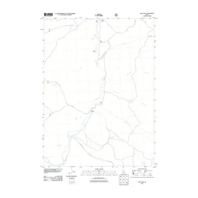
2011 Map of Blue Hill
USGS Topo · Published 2011About this map
Goose Creek flows through this high-desert drainage of Cassia County, carving a central corridor that defines the local ranching and transit patterns. The terrain is marked by numerous water sources vital for livestock and settlement, including Poulton Spring and Wilson Spring in the northern reaches, and Worthington Spring to the southeast. The landscape is deeply etched by canyons and gulches, notably Day Canyon and Devine Canyon, which provide natural conduits for backcountry roads like Goose Creek Rd and Coal Bank Rd. Evidence of the area's agricultural heritage is found in the naming of Double Diamond Ranch Rd, while the prominent Blue Hill serves as a central landmark overlooking Blue Hill Creek. This survey captures the essential hydrography and primitive road network of the Idaho backcountry at the start of the 21st century.
Find a feature on this map
26 named features on this map. Tap any name to fly to it.
Don’t see what you’re looking for? This feature index may not catch every label — zoom into the map to look around manually.
Map Details
Editions of this 2011 Blue Hill Map
This is the sole edition of this map. No revisions or reprints were ever made.
Other maps of this area

1954 · Pocatello
USGS Topo · 1:250,000

1954 · Brigham City
USGS Topo · 1:250,000

1955 · Twin Falls
USGS Topo · 1:250,000

1955 · Wells
USGS Topo · 1:250,000

1958 · Wells
USGS Topo · 1:250,000

1958 · Twin Falls
USGS Topo · 1:250,000

1958 · Pocatello
USGS Topo · 1:250,000

1958 · Brigham City
USGS Topo · 1:250,000

1959 · Cotton Thomas Basin
USGS Topo · 1:62,500

1961 · Wells
USGS Topo · 1:250,000