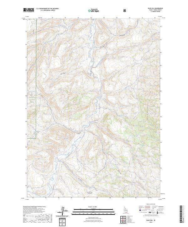
2024 Map of Blue Hill
USGS Topo · Published 2024About this map
Blue Hill serves as a central landmark in this high-elevation landscape of Cassia County, where the Goose Creek Mountains meet the eastern edge of the Sawtooth National Forest. The drainage pattern is defined by the significant flow of Goose Creek, which is fed by numerous seasonal tributaries and high-country springs including Wilson Spring, Coal Banks Spring, and Horseshoe Spring. This area is characterized by deep incisions in the terrain such as Day Canyon and Big Canyon, which illustrate the complex erosional history of the Middle Mountain region.
Find a feature on this map
32 named features on this map. Tap any name to fly to it.
Don’t see what you’re looking for? This feature index may not catch every label — zoom into the map to look around manually.
Map Details
Editions of this 2024 Blue Hill Map
This is the sole edition of this map. No revisions or reprints were ever made.
Other maps of this area

1954 · Pocatello
USGS Topo · 1:250,000

1954 · Brigham City
USGS Topo · 1:250,000

1955 · Twin Falls
USGS Topo · 1:250,000

1955 · Wells
USGS Topo · 1:250,000

1958 · Wells
USGS Topo · 1:250,000

1958 · Twin Falls
USGS Topo · 1:250,000

1958 · Pocatello
USGS Topo · 1:250,000

1958 · Brigham City
USGS Topo · 1:250,000

1959 · Cotton Thomas Basin
USGS Topo · 1:62,500

1961 · Wells
USGS Topo · 1:250,000