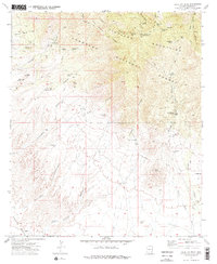
1972 Map of Blue Jay Peak
USGS Topo · Published 1975About this map
KH Ranch and the Seventy-six Ranch anchor this 1970s landscape within the Coronado National Forest, where the high elevations of the Pinaleno Mountains meet the canyon-cut lowlands. Mining activity is evident through the President Mine and various Prospects scattered near Lindsey Canyon. Local history is captured in the solitary Lindsey Grave located near Lindsey Tank, reflecting the early cattle and mining heritage of this corner of Graham County.
Find a feature on this map
54 named features on this map. Tap any name to fly to it.
Don’t see what you’re looking for? This feature index may not catch every label — zoom into the map to look around manually.
Map Details
Editions of this 1972 Blue Jay Peak Map
2 editions found
Other maps of this area

1940 · Sierra Bonita Ranch
USGS Topo · 1:62,500

1942 · Sierra Bonita Ranch
USGS Topo · 1:62,500

1942 · Mt. Graham
USGS Topo · 1:62,500

1943 · Sierra Bonita Ranch
USGS Topo · 1:62,500

1944 · Jackson Mtn.
USGS Topo · 1:62,500

1945 · Mt. Graham
USGS Topo · 1:62,500

1946 · Jackson Mtn.
USGS Topo · 1:62,500

1954 · Silver City
USGS Topo · 1:250,000

1956 · Tucson
USGS Topo · 1:250,000

1958 · Silver City
USGS Topo · 1:250,000