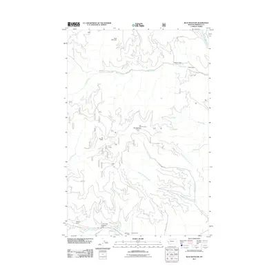
2011 Map of Blue Mountain
USGS Topo · Published 2011About this map
Blue Mountain and its surrounding drainages dominate this 2011 survey, showing a landscape defined by steep gulches and high ridges southwest of Missoula. The Blue Mountain Lookout and Blue Mountain Saddle serve as central landmarks, with several forest roads such as Sleeman Creek Rd and O'Brien Creek Rd providing access through the rugged terrain. Along the southern edge near West Fork Lolo Creek, the Chickaman Mine points to the area's history of mineral exploration. The drainage patterns are intricate, featuring the Bitterroot River in the northeast and numerous creek systems including O'Brien Creek, Hayes Creek, and the various forks of Sleeman Creek. These watercourses and their associated gulches, such as Lyon Gulch and Hagerty Gulch, illustrate the complex topography of the Sapphire and Bitterroot Mountain foothills.
Find a feature on this map
28 named features on this map. Tap any name to fly to it.
Don’t see what you’re looking for? This feature index may not catch every label — zoom into the map to look around manually.
Map Details
Editions of this 2011 Blue Mountain Map
This is the sole edition of this map. No revisions or reprints were ever made.
Other maps of this area

1912 · Missoula
USGS Topo · 1:125,000

1956 · Hamilton
USGS Topo · 1:250,000

1959 · Hamilton
USGS Topo · 1:250,000

1960 · Hamilton
USGS Topo · 1:250,000

1963 · Primrose
USGS Topo · 1:24,000

1964 · Hamilton
USGS Topo · 1:250,000
1964 · Diamond Point
USGS Topo · 1:24,000

1964 · Dick Creek
USGS Topo · 1:24,000
1964 · Northwest Missoula
USGS Topo · 1:24,000
1964 · Blue Mountain
USGS Topo · 1:24,000