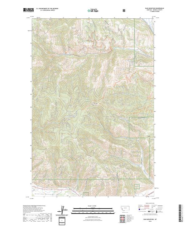
2024 Map of Blue Mountain
USGS Topo · Published 2024About this map
The Lolo National Forest dominates this section of the Bitterroot Mountains west of the Missoula valley. The landscape is defined by the Grave Creek Range and numerous drainage systems like Sleeman Creek and O'Brien Creek that carve through the timbered slopes. Along the eastern edge, the settlement of Lolo serves as a gateway to the mountains, situated near where the Big Flat Ditch marks the transition from agricultural valley floor to the forested foothills of Blue Mtn.
Find a feature on this map
48 named features on this map. Tap any name to fly to it.
Don’t see what you’re looking for? This feature index may not catch every label — zoom into the map to look around manually.
Map Details
Editions of this 2024 Blue Mountain Map
This is the sole edition of this map. No revisions or reprints were ever made.
Other maps of this area

1912 · Missoula
USGS Topo · 1:125,000

1956 · Hamilton
USGS Topo · 1:250,000

1959 · Hamilton
USGS Topo · 1:250,000

1960 · Hamilton
USGS Topo · 1:250,000

1963 · Primrose
USGS Topo · 1:24,000

1964 · Hamilton
USGS Topo · 1:250,000
1964 · Diamond Point
USGS Topo · 1:24,000

1964 · Dick Creek
USGS Topo · 1:24,000
1964 · Northwest Missoula
USGS Topo · 1:24,000
1964 · Blue Mountain
USGS Topo · 1:24,000