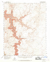
1955 Map of Blue Spring
USGS Topo · Published 1970About this map
The Little Colorado River carves a deep path through Coconino County, defining the western edge of the Navajo Indian Reservation. This mid-century survey documents the dramatic descent of the Little Colorado River Gorge and its convergence with complex drainage systems like Big Navajo Canyon and Salt Trail Canyon. The presence of Blue Spring provides a vital focal point in a landscape otherwise defined by arid washes like Sheep Wash and Dry Wash.
Find a feature on this map
25 named features on this map. Tap any name to fly to it.
Don’t see what you’re looking for? This feature index may not catch every label — zoom into the map to look around manually.
Map Details
Editions of this 1955 Blue Spring Map
3 editions found

Other maps of this area

1886 · San Francisco Mtns
USGS Topo · 1:250,000

1886 · Echo Cliffs
USGS Topo · 1:250,000

1891 · San Francisco Mtns
USGS Topo · 1:250,000

1891 · Echo Cliffs
USGS Topo · 1:250,000

1894 · San Francisco Mtns
USGS Topo · 1:250,000

1899 · San Francisco Mtns
USGS Topo · 1:250,000

1907 · Vishnu
USGS Topo · 1:48,000

1947 · Flagstaff
USGS Topo · 1:250,000

1954 · Shinumo Altar SE
USGS Topo · 1:24,000

1954 · Nankoweap
USGS Topo · 1:62,500