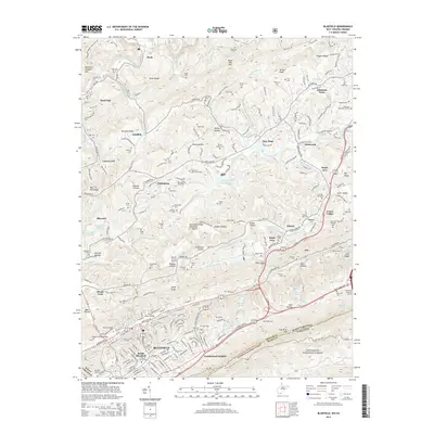
2014 Map of Bluefield
USGS Topo · Published 2014About this map
Bluefield and its surrounding communities sit at a critical crossroads of the Appalachian highlands, where the West Virginia and Virginia state line follows the crest of East River Mountain. This 2014 survey documents the dense urban infrastructure of South Bluefield and Cumberland Heights alongside the essential transport links of the Norfolk Southern railroad. The landscape is defined by its deep hollows and ridges, such as Hatcher Hollow and Hurricane Ridge, which have historically dictated the placement of settlements like Montcalm and Bluewell. Numerous family and community cemeteries, including the Restlawn Memorial Estate and Roselawn Memorial Garden, are scattered across the terrain, offering significant data for genealogical research. Notable engineering feats are present, from the East River Mountain Tunnel to the Frank S Easley Bridge, which facilitate movement through this complex topography.
Find a feature on this map
241 named features on this map. Tap any name to fly to it.
Don’t see what you’re looking for? This feature index may not catch every label — zoom into the map to look around manually.
Map Details
Editions of this 2014 Bluefield Map
This is the sole edition of this map. No revisions or reprints were ever made.
Other maps of this area

1887 · Pocahontas
USGS Topo · 1:125,000

1891 · Pocahontas
USGS Topo · 1:125,000

1894 · Pocahontas
USGS Topo · 1:125,000

1895 · Pocahontas
USGS Topo · 1:125,000

1909 · Pocahontas Special
USGS Topo · 1:48,000

1911 · Pocahontas Special
USGS Topo · 1:62,500

1913 · Bluefield
USGS Topo · 1:48,000

1916 · Bluefield
USGS Topo · 1:62,500

1924 · Bramwell
USGS Topo · 1:62,500

1924 · Bluefield
USGS Topo · 1:62,500