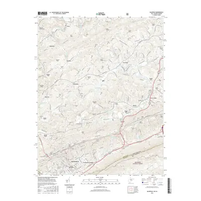
2016 Map of Bluefield
USGS Topo · Published 2016About this map
Bluefield stands as a central hub in this Appalachian borderland, where the ridges of the Jefferson National Forest meet the industrialized valley of the Bluestone River. The landscape is a dense network of family heritage and early industry, marked by dozens of burial grounds like Smith Chapel Cem and Sandlick Cem. While the southern edge is dominated by the city and institutions like Bluefield State Coll, the northern reaches transition into a series of sharp ridges and hollows, including Hatcher Hollow and Stillhouse Hollow. This 2016 survey captures the area's complex infrastructure, from the Norfolk Southern railroad lines to the East River Mountain Tunnel on the Virginia state line. Notable landmarks like the Grant Street Bridge and Doctor Daniel Hale Lake provide specific points of reference for those tracing local development and civic history within Mercer County.
Find a feature on this map
252 named features on this map. Tap any name to fly to it.
Don’t see what you’re looking for? This feature index may not catch every label — zoom into the map to look around manually.
Map Details
Editions of this 2016 Bluefield Map
This is the sole edition of this map. No revisions or reprints were ever made.
Other maps of this area

1887 · Pocahontas
USGS Topo · 1:125,000

1891 · Pocahontas
USGS Topo · 1:125,000

1894 · Pocahontas
USGS Topo · 1:125,000

1895 · Pocahontas
USGS Topo · 1:125,000

1909 · Pocahontas Special
USGS Topo · 1:48,000

1911 · Pocahontas Special
USGS Topo · 1:62,500

1913 · Bluefield
USGS Topo · 1:48,000

1916 · Bluefield
USGS Topo · 1:62,500

1924 · Bramwell
USGS Topo · 1:62,500

1924 · Bluefield
USGS Topo · 1:62,500