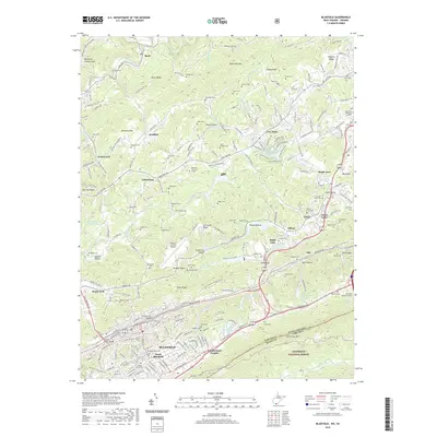
2019 Map of Bluefield
USGS Topo · Published 2019About this map
Bluefield sits at the southern edge of the Appalachian coalfields, where the high ridges of East River Mtn form the state line between West Virginia and Virginia. This modern survey illustrates the complex geography of the city, from the downtown streets near Bluefield Ave to the residential heights of South Bluefield and Cumberland Heights. The landscape is defined by its deep hollows and prominent ridges, such as Browning Lambert Mtn and Micajah Ridge, which historically funneled travel through gaps like Stony Gap.
Find a feature on this map
224 named features on this map. Tap any name to fly to it.
Don’t see what you’re looking for? This feature index may not catch every label — zoom into the map to look around manually.
Map Details
Editions of this 2019 Bluefield Map
This is the sole edition of this map. No revisions or reprints were ever made.
Other maps of this area

1887 · Pocahontas
USGS Topo · 1:125,000

1891 · Pocahontas
USGS Topo · 1:125,000

1894 · Pocahontas
USGS Topo · 1:125,000

1895 · Pocahontas
USGS Topo · 1:125,000

1909 · Pocahontas Special
USGS Topo · 1:48,000

1911 · Pocahontas Special
USGS Topo · 1:62,500

1913 · Bluefield
USGS Topo · 1:48,000

1916 · Bluefield
USGS Topo · 1:62,500

1924 · Bramwell
USGS Topo · 1:62,500

1924 · Bluefield
USGS Topo · 1:62,500