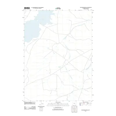
2012 Map of Bluegrass Wells
USGS Topo · Published 2012About this map
Wheatland Reservoir Number 2 dominates the northwestern corner of this Albany County landscape, its irregular shoreline indicating the managed water levels of this high-plains region. The terrain is defined by the winding paths of the Bluegrass Creek system, including W Bluegrass Cr and E Bluegrass Cr, which carve through the open country. At the center of this drainage network lies Bluegrass Wells, a localized point of interest in an otherwise sparse and wide-open expanse. A grid of local roads and 4WD tracks connects these remote water features, reflecting the infrastructure necessary for land management and ranching in the early 21st century. This survey offers a clear view of the hydrological and transportation patterns across this specific section of the Wyoming interior.
Find a feature on this map
4 named features on this map. Tap any name to fly to it.
Don’t see what you’re looking for? This feature index may not catch every label — zoom into the map to look around manually.
Map Details
Editions of this 2012 Bluegrass Wells Map
This is the sole edition of this map. No revisions or reprints were ever made.
Other maps of this area

1954 · Cheyenne
USGS Topo · 1:250,000

1955 · Mc Gill Lakes
USGS Topo · 1:24,000

1955 · Dodge Ranch
USGS Topo · 1:24,000

1955 · Bluegrass Wells
USGS Topo · 1:24,000

1955 · Sybille Springs
USGS Topo · 1:24,000

1955 · Ayres Spring
USGS Topo · 1:24,000

1955 · Lake Ione
USGS Topo · 1:24,000

1955 · Guide Rock
USGS Topo · 1:24,000

1955 · Sheep Rock
USGS Topo · 1:24,000

1955 · Bull Camp Peak
USGS Topo · 1:24,000