
1955 Map of Bull Camp Peak
USGS Topo · Published 1957About this map
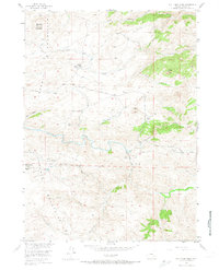
The Laramie Mountains dominate this mid-century landscape in Albany County, where the Laramie River winds through high-altitude canyons and basins. Remote ranching outposts like the Kennedy Ranch and the small Kennedy Sch speak to the isolated rural life of the era, while infrastructure like the Wheatland Tunnel No 2 and its associated Wheatland Tunnel Road reflect mid-century efforts to manage water resources for the Missouri River Basin. Significant peaks and landmarks such as Douthitt Mountain, Sugar Loaf, and Elmers Rock provide a detailed topographic view of the terrain before later modern development. This survey, grounded in 1949 aerial photography and 1955 field checks, captures a specific moment in Wyoming's pastoral and engineering history, marking the location of high-country settlements like Bull Camp and the prominent Bull Camp Peak.
Find a feature on this map
27 named features on this map. Tap any name to fly to it.
Don’t see what you’re looking for? This feature index may not catch every label — zoom into the map to look around manually.
Map Details
Editions of this 1955 Bull Camp Peak Map
3 editions found
Other maps of this area

1954 · Torrington
USGS Topo · 1:250,000

1954 · Cheyenne
USGS Topo · 1:250,000

1955 · Poe Mountain
USGS Topo · 1:24,000

1955 · Dodge Ranch
USGS Topo · 1:24,000

1955 · Bluegrass Wells
USGS Topo · 1:24,000

1955 · Moonshine Peak
USGS Topo · 1:24,000

1955 · Guide Rock
USGS Topo · 1:24,000

1958 · Cheyenne
USGS Topo · 1:250,000

1958 · Torrington
USGS Topo · 1:250,000

1968 · Davidson Flats
USGS Topo · 1:24,000