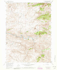
1955 Map of Bull Camp Peak
USGS Topo · Published 1982About this map
Kennedy Ranch and the nearby Kennedy Sch anchor this corner of the Laramie Mountains, showing a mid-century ranching landscape defined by high-altitude drainages and winding waterways. The Laramie River carves a complex path through the center of the sheet, joined by seasonal flows from Dipping Vat Creek and Log Creek. The terrain is marked by significant vertical relief, with Bull Camp Peak and Elmers Rock serving as prominent landmarks for those navigating the backcountry.
Find a feature on this map
22 named features on this map. Tap any name to fly to it.
Don’t see what you’re looking for? This feature index may not catch every label — zoom into the map to look around manually.
Map Details
Editions of this 1955 Bull Camp Peak Map
3 editions found
Other maps of this area

1954 · Torrington
USGS Topo · 1:250,000

1954 · Cheyenne
USGS Topo · 1:250,000

1955 · Poe Mountain
USGS Topo · 1:24,000

1955 · Dodge Ranch
USGS Topo · 1:24,000

1955 · Bluegrass Wells
USGS Topo · 1:24,000

1955 · Moonshine Peak
USGS Topo · 1:24,000

1955 · Guide Rock
USGS Topo · 1:24,000

1955 · Bull Camp Peak
USGS Topo · 1:24,000

1958 · Cheyenne
USGS Topo · 1:250,000

1958 · Torrington
USGS Topo · 1:250,000