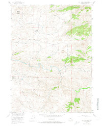
1955 Map of Bull Camp Peak
USGS Topo · Published 1974About this map
The Laramie Mountains dominate this 1955 survey of the Wyoming high country, where the winding Laramie River carves through the central terrain. This landscape is a patchwork of water management and high-altitude ranching, evidenced by the presence of the Wheatland Tunnel No 1 and Wheatland Tunnel No 2. These engineering features highlight the importance of water diversion in Albany County during the mid-century era.
Find a feature on this map
29 named features on this map. Tap any name to fly to it.
Don’t see what you’re looking for? This feature index may not catch every label — zoom into the map to look around manually.
Map Details
Editions of this 1955 Bull Camp Peak Map
3 editions found
Other maps of this area

1954 · Torrington
USGS Topo · 1:250,000

1954 · Cheyenne
USGS Topo · 1:250,000

1955 · Poe Mountain
USGS Topo · 1:24,000

1955 · Dodge Ranch
USGS Topo · 1:24,000

1955 · Bluegrass Wells
USGS Topo · 1:24,000

1955 · Moonshine Peak
USGS Topo · 1:24,000

1955 · Guide Rock
USGS Topo · 1:24,000

1955 · Bull Camp Peak
USGS Topo · 1:24,000

1958 · Cheyenne
USGS Topo · 1:250,000

1958 · Torrington
USGS Topo · 1:250,000