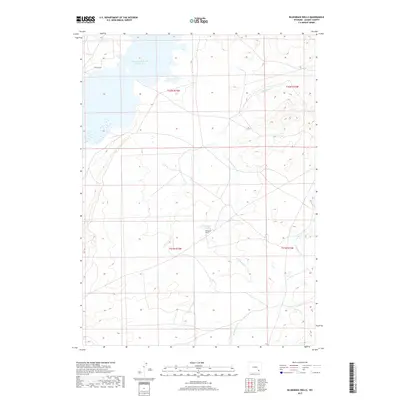
2017 Map of Bluegrass Wells
USGS Topo · Published 2017About this map
Wheatland Reservoir Number Two dominates the northwestern corner of this high-plains landscape, where the waters meet a network of seasonal drainages and prairie tracks. The namesake Bluegrass Wells serves as a focal point for the surrounding topography, located centrally near the junction of several section lines. The hydrography of the region is defined by the winding paths of W Bluegrass Cr and E Bluegrass Cr, which carve through the terrain as they flow toward the Laramie River basin. This 2017 survey illustrates the modern division of these expansive Albany County lands, showing the intersection of Township and Range lines such as t22n r73w and t21n r72w. Apart from the rural access of Solstice Dr, the area remains largely defined by its open ranching character and essential water resources.
Find a feature on this map
9 named features on this map. Tap any name to fly to it.
Don’t see what you’re looking for? This feature index may not catch every label — zoom into the map to look around manually.
Map Details
Editions of this 2017 Bluegrass Wells Map
This is the sole edition of this map. No revisions or reprints were ever made.
Other maps of this area

1954 · Cheyenne
USGS Topo · 1:250,000

1955 · Mc Gill Lakes
USGS Topo · 1:24,000

1955 · Dodge Ranch
USGS Topo · 1:24,000

1955 · Bluegrass Wells
USGS Topo · 1:24,000

1955 · Sybille Springs
USGS Topo · 1:24,000

1955 · Ayres Spring
USGS Topo · 1:24,000

1955 · Lake Ione
USGS Topo · 1:24,000

1955 · Guide Rock
USGS Topo · 1:24,000

1955 · Sheep Rock
USGS Topo · 1:24,000

1955 · Bull Camp Peak
USGS Topo · 1:24,000