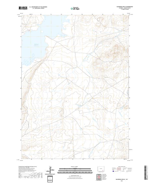
2021 Map of Bluegrass Wells
USGS Topo · Published 2021About this map
Wheatland Reservoir Number Two dominates the northwest corner of this Albany County landscape, its expansive waters contrasting with the high-plains terrain of the Laramie Mountains region. The hydrology of the area is defined by the branching network of the Bluegrass Creek system, including West Bluegrass Creek and E Bluegrass Cr. These drainage patterns reflect the essential role of water management in Wyoming's semi-arid ranching country. The eponymous Bluegrass Wells sits near the center of the sheet, likely representing a critical point of groundwater access for local agriculture or livestock. Most of the land remains divided by the Public Land Survey System, with township boundaries like t21n r73w and t22n r72w marking the grid-based development of the territory. Isolated roads such as Solstice Dr provide minimal access into the interior, which is characterized by broad contours and intermittent stream beds.
Find a feature on this map
10 named features on this map. Tap any name to fly to it.
Don’t see what you’re looking for? This feature index may not catch every label — zoom into the map to look around manually.
Map Details
Editions of this 2021 Bluegrass Wells Map
This is the sole edition of this map. No revisions or reprints were ever made.
Other maps of this area

1954 · Cheyenne
USGS Topo · 1:250,000

1955 · Mc Gill Lakes
USGS Topo · 1:24,000

1955 · Dodge Ranch
USGS Topo · 1:24,000

1955 · Bluegrass Wells
USGS Topo · 1:24,000

1955 · Sybille Springs
USGS Topo · 1:24,000

1955 · Ayres Spring
USGS Topo · 1:24,000

1955 · Lake Ione
USGS Topo · 1:24,000

1955 · Guide Rock
USGS Topo · 1:24,000

1955 · Sheep Rock
USGS Topo · 1:24,000

1955 · Bull Camp Peak
USGS Topo · 1:24,000